M
MicahMan
Unregistered Guest
Saturday night the 1st of March 2014 I received a last second invite to go camping. My wife was kind enough to oblige and I threw my gear in the old 40 and I was ready.
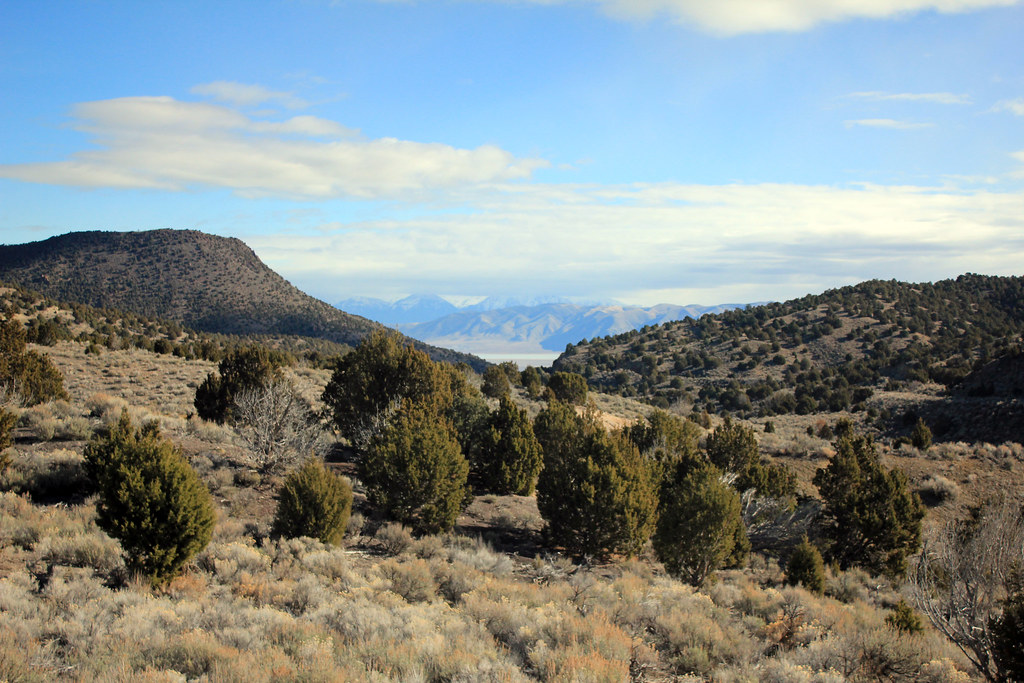
Kurt Williams and Stephen Nielson were in charge of destination so we threw around ideas. Meeting at the Chevron in Saratoga Springs our loose plan was formulated. My only requirement was that it be someplace new to me. I am still exploring the West Desert so new isn't a strict requirement.
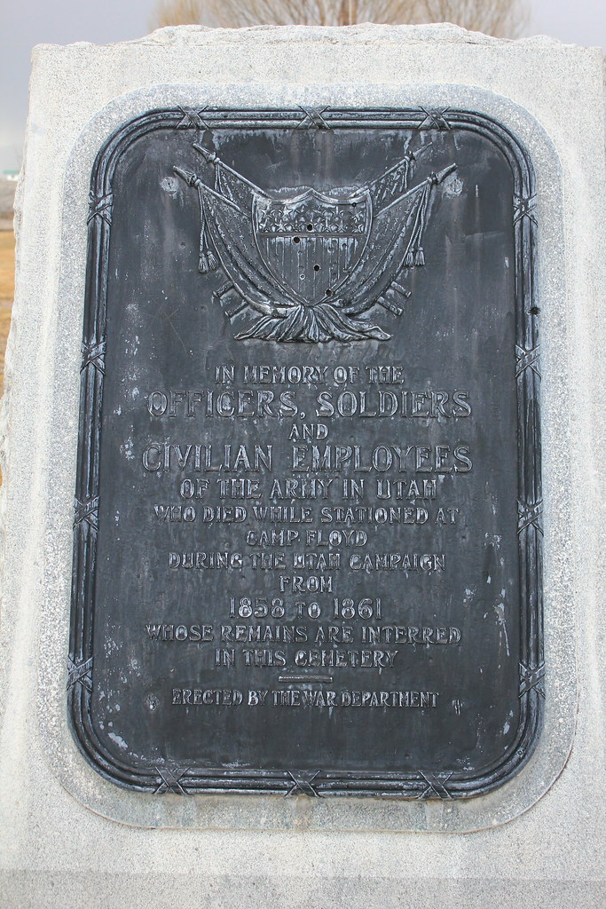
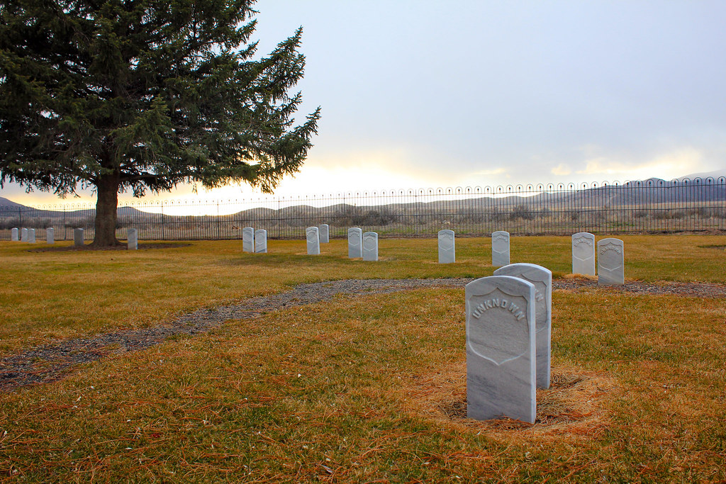
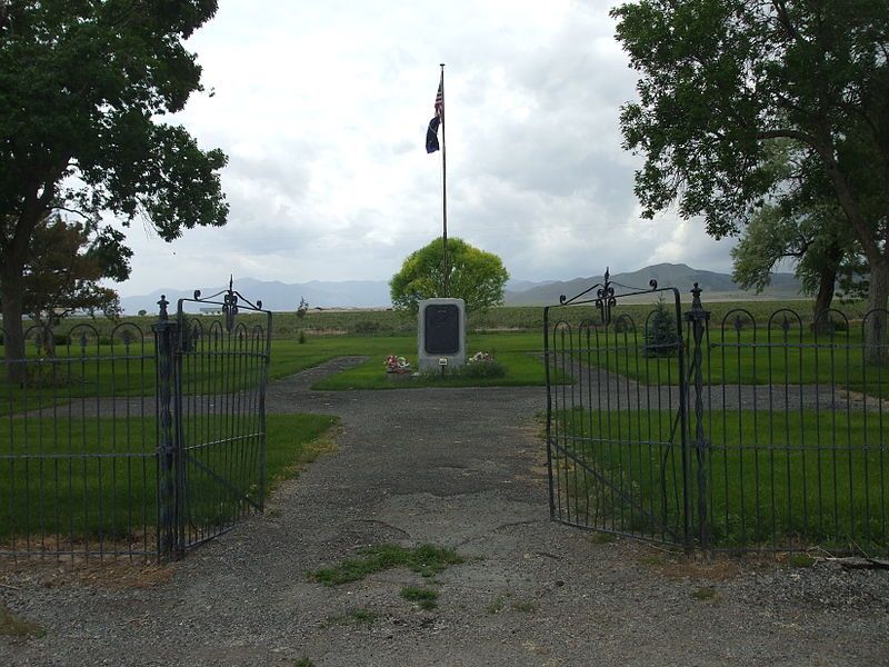
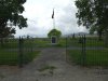
We headed west with a plan to take "Government Road" This had us stop by the Camp Floyd Cemetary. http://en.wikipedia.org/wiki/Camp_Floyd_/_Stagecoach_Inn_State_Park_and_Museum
A very fun and interesting place to see as all the graves were listed as "Unknown", but there were a few that had more information on how they came to be in the cemetery.
Here are my favorites:
"Murdered", "Found Dead", "Self-Inflicted Gunshot Wound" this appeared numerous times, "Diabetes", "Typhoid".
The memorial was erected by the American Legion. My grandfather is a member and I'm trying to find more information or a point of contact that would allow us there for a camp. The grounds were beautiful.
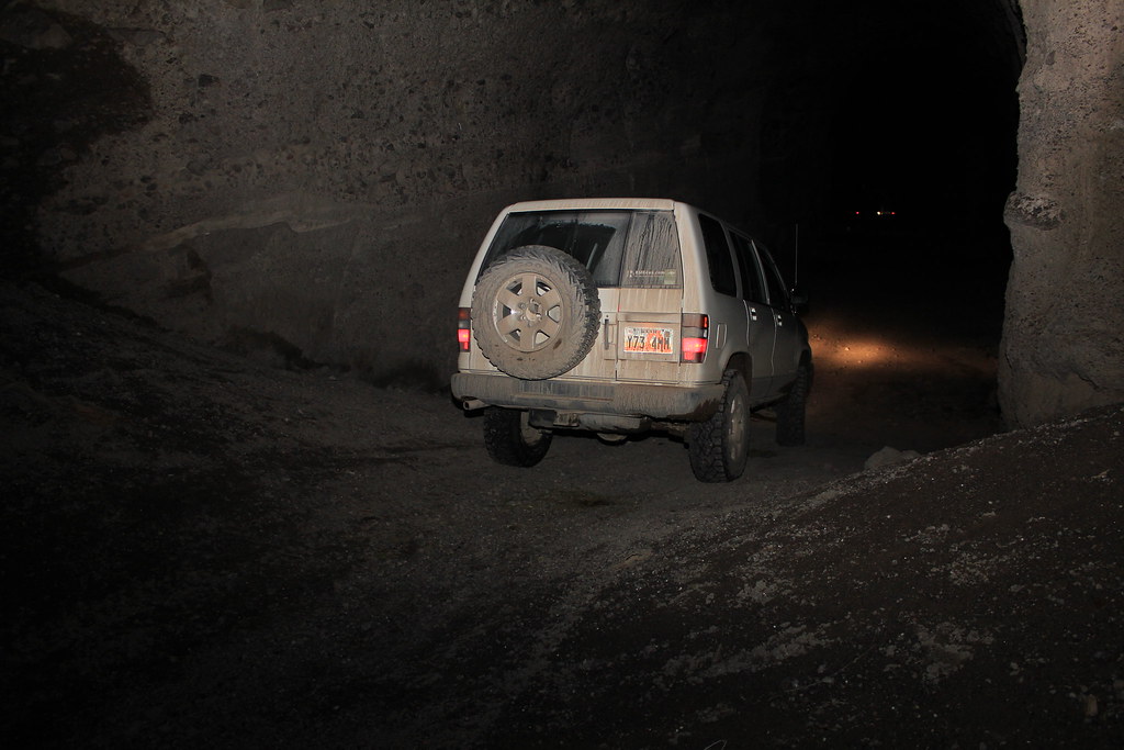
We then moved a few more miles to a mine shaft/cave that Kurt had used for Rappel training. I drove right past it as the opening does hide itself very well. We scared a few bats and pigeons throwing rocks and hearing them land almost 100 feet below. It was just high enough it made me nervous jumping over the openings.
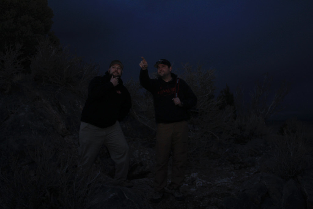
By this time the sun was waning and we were looking for a good place to camp. The Eureka Rail System has a tunnel that is no longer used. In fact the rails and wood have long since been reclaimed.
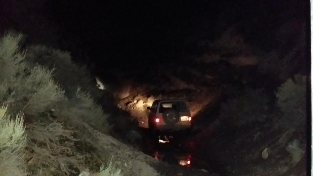
This is Stephen pointing his lights at the cave.
This is Kurt Blinding us with his lights.
Kurt brought Jake Chatwin along so there were four of us to BS around the fire. Pie irons were brought out and there was plenty of food and stories. Great time as we actually camped inside the tunnel with our fire lighting the walls.
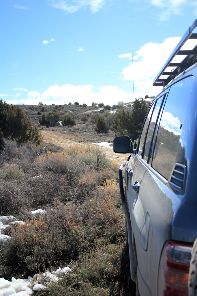
We had a slow start Monday morning as we had no real schedule. Beautiful day with sun shining made our three happy to be on the trail.
A short pit stop at the BYU fire bomb mine shaft. Recent construction looks to be closing this off. Kurt almost threw his phone down the shaft as well.
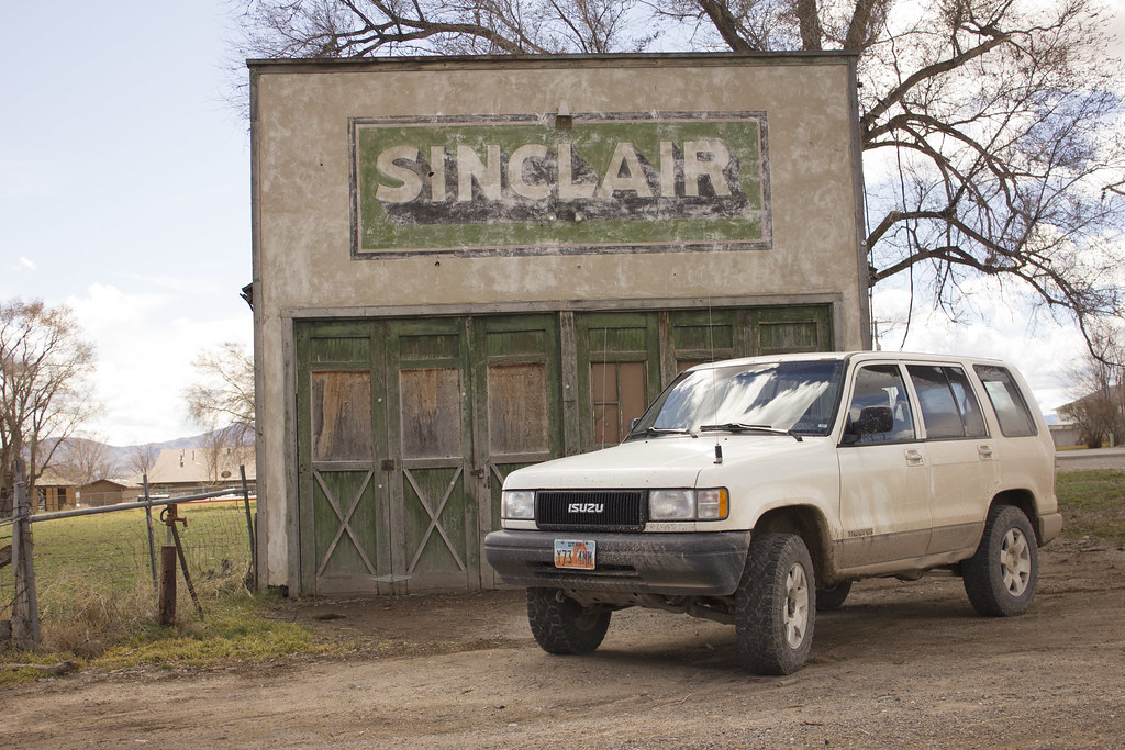
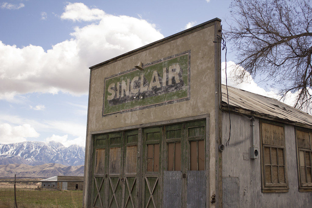
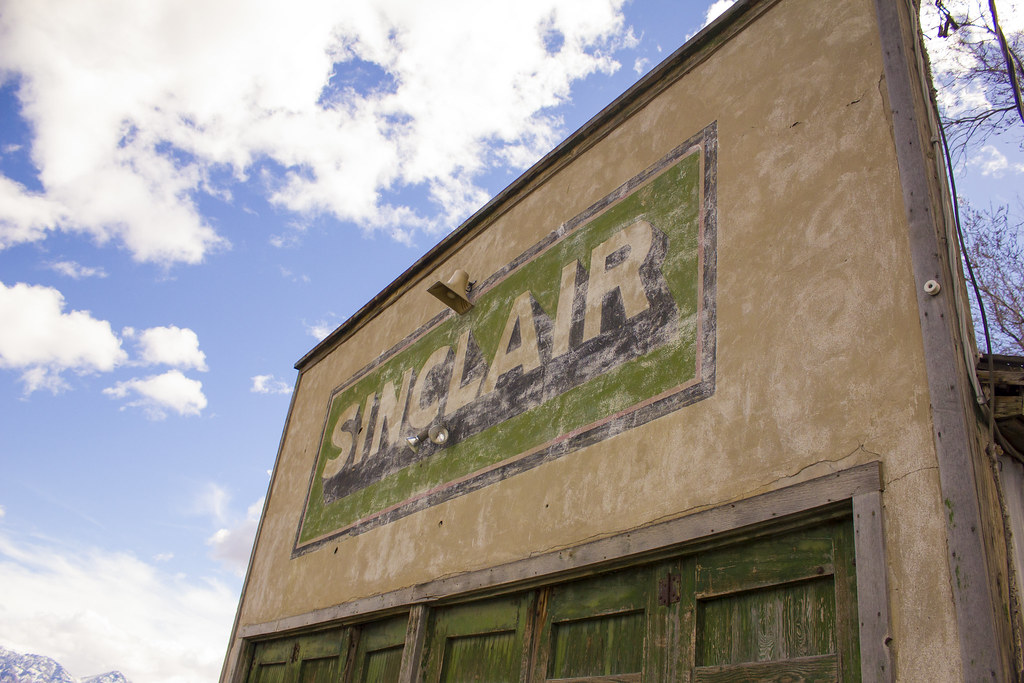
Getting on HWY 6 it was a couple miles south and west to Eureka. I believe the old town might have been called Knighton, but I'm sure Stephen or Kurt will correct.
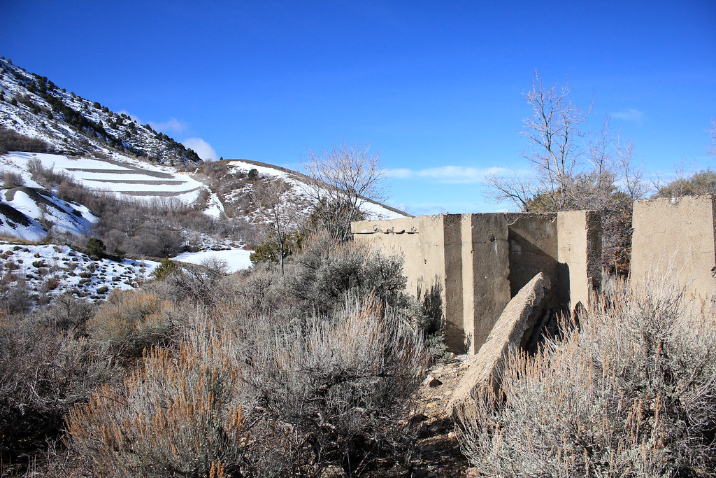
Interesting little town with not much there. You see tailings and the tell tell signs of people, but the coolest item was the School House foundation.
I then took off to head home and catch up with my family, but it was an amazing time and I so enjoyed being out in the hills.
Sometimes you have to do as Jeff Bridges does in Tron. "Knock on the sky, and listen to the sound"
Micah Platt
Kurt Williams and Stephen Nielson were in charge of destination so we threw around ideas. Meeting at the Chevron in Saratoga Springs our loose plan was formulated. My only requirement was that it be someplace new to me. I am still exploring the West Desert so new isn't a strict requirement.
We headed west with a plan to take "Government Road" This had us stop by the Camp Floyd Cemetary. http://en.wikipedia.org/wiki/Camp_Floyd_/_Stagecoach_Inn_State_Park_and_Museum
A very fun and interesting place to see as all the graves were listed as "Unknown", but there were a few that had more information on how they came to be in the cemetery.
Here are my favorites:
"Murdered", "Found Dead", "Self-Inflicted Gunshot Wound" this appeared numerous times, "Diabetes", "Typhoid".
The memorial was erected by the American Legion. My grandfather is a member and I'm trying to find more information or a point of contact that would allow us there for a camp. The grounds were beautiful.
We then moved a few more miles to a mine shaft/cave that Kurt had used for Rappel training. I drove right past it as the opening does hide itself very well. We scared a few bats and pigeons throwing rocks and hearing them land almost 100 feet below. It was just high enough it made me nervous jumping over the openings.
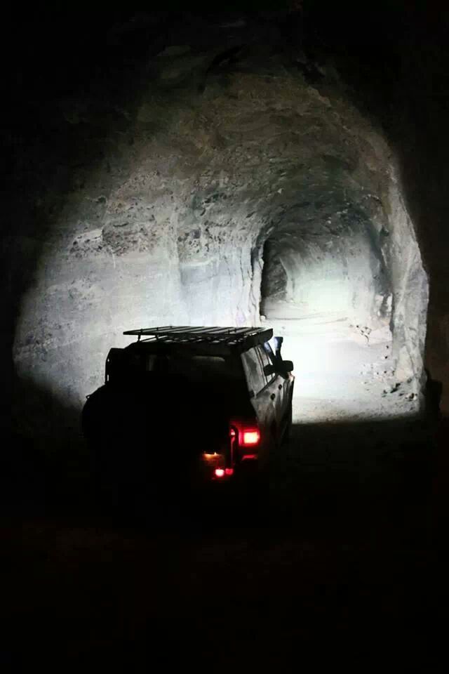
By this time the sun was waning and we were looking for a good place to camp. The Eureka Rail System has a tunnel that is no longer used. In fact the rails and wood have long since been reclaimed.
This is Stephen pointing his lights at the cave.
This is Kurt Blinding us with his lights.
Kurt brought Jake Chatwin along so there were four of us to BS around the fire. Pie irons were brought out and there was plenty of food and stories. Great time as we actually camped inside the tunnel with our fire lighting the walls.
We had a slow start Monday morning as we had no real schedule. Beautiful day with sun shining made our three happy to be on the trail.
A short pit stop at the BYU fire bomb mine shaft. Recent construction looks to be closing this off. Kurt almost threw his phone down the shaft as well.
Getting on HWY 6 it was a couple miles south and west to Eureka. I believe the old town might have been called Knighton, but I'm sure Stephen or Kurt will correct.
Interesting little town with not much there. You see tailings and the tell tell signs of people, but the coolest item was the School House foundation.
I then took off to head home and catch up with my family, but it was an amazing time and I so enjoyed being out in the hills.
Sometimes you have to do as Jeff Bridges does in Tron. "Knock on the sky, and listen to the sound"
Micah Platt

.JPG")
.JPG")
.JPG")